Train Tracks crossing Wilson, Downsview Station
Downsview in the late 50s and early 60s

CNR Train tracks crossing Wilson. (1964)
They eventually built a bridge and Wilson passed under the tracks.
A few times I jumped trains on my way home from high school.
Or I would walk south down the tracks and look at the trains in the train yard.
The photo descriptions mentions "Downsview Lumber and Supply" - that I remember
being along Murray Street.
Railway tracks crossing Wilson just around Murray Rd, (1964)

Grand Trunk Railway and Downsview Station
The next picture shows an interesting piece of Downsview history ...
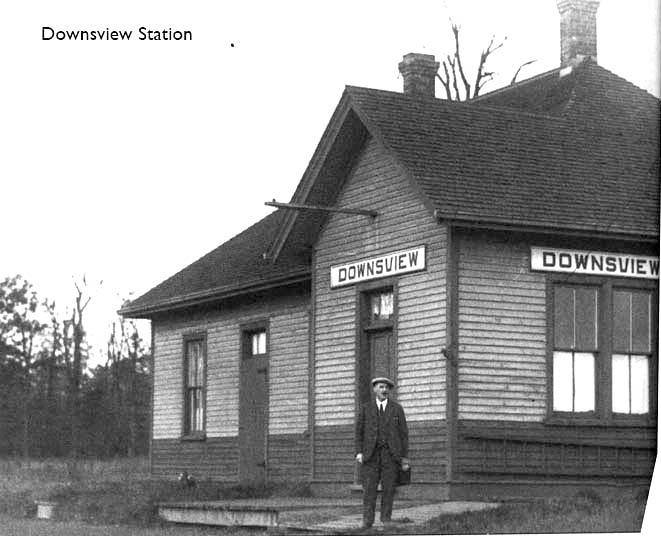
There is no date for this picture, but from the suit and quality of photograph
and from the undeveloped forest background, let's say about 1910.
Where is it?
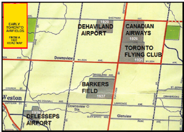
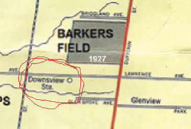
Now let's look at this picture ... See the "Downsview station" on Lawrence Avenue east from the railway tracks.
Now again, see the "Downsview station" on Lawrence Avenue east from the railway tracks on this circa 1892 map.
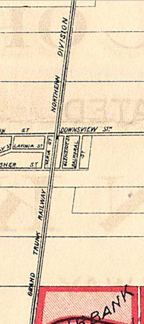
from
http://oldtorontomaps.blogspot.ca/2013/01/1892Map-of-Toronto-Showing-BeltLine-Route.html
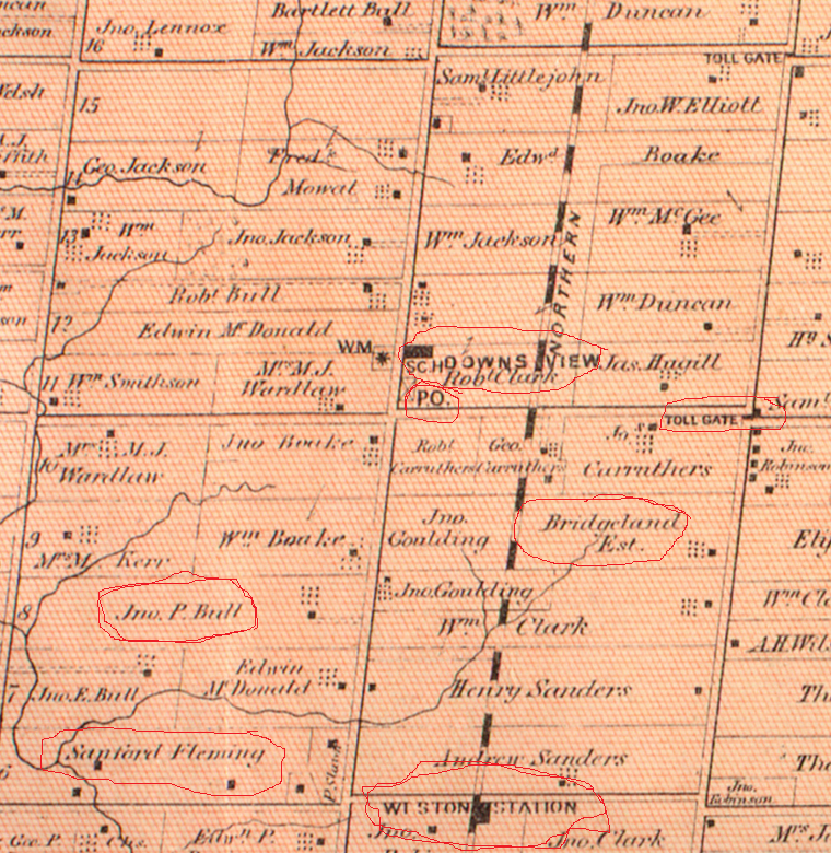
But compare that to the interesting 1880 map showing Downsview from the McGill County Atlas Project. It shows "Weston Station" on Lawrence where the Airports map has "Downsview Station" and Downsview (Post Office) over at Keele and Wilson.
See ...
http://digital.library.mcgill.ca/countyatlas/Images/Maps/TownshipMaps/yor-m-york-n.jpg
for the large size one. We can also see John Perkins Bull's property. It looks like Sir Sanford Flemming had some property not far from John's. Dufferin Street had some kind of toll gate.
It's not surprising Lawrence Avenue was considered to be part of Downsview as it was likely the gateway
to John Perkins Bull's property -- whose farm historically defined Downsview.
Compare the above with the interesting
Belt line map shewing northern suburbs of Toronto. 1890
Compiled by Unwin, Foster & Proudfoot, published by Alexander & Cable, 1890.
Map courtesy Toronto Public Library: T1890-2/4Mlrg c1
The source for the air fields map is the Downsview Advocate Also, make sure you visit Downsview Lands Community
Return to the Downsview 1960s Home Page